I’d never planned or intended to go on a solo climb, let alone one of this length. My plans just evolved a little bit at a time, from trying to get one or two peaks closer to my 46, to getting a crew together to finish the whole thing, to what I thought I would do by the time I left Albany last Thursday afternoon: spend about a day going all-out as fast as I could to bag a few on my own then meeting up with the rest of my group.
My troubles started even just getting to Albany, with my train almost an hour late and essentially zero time to make the connection (a 15-minute jog over the Hudson, or a prayer for a taxi) to the bus station to get to Keene. I got there just as the bus was departing, flagged the damn thing down, somehow they let me on, and the adventure began. The only other people on the bus were a single mother with three howling toddlers, and a group of rather concerned backpackers. These are the ones I’d begin making friends with: three upper crust British blokes on their grand tour after university, somewhat clueless but thoroughly adventurous. (As an aside, their own plans had, before my intervention and advice, consisted of hiking routes 28 and 30 from Chesterton to their ultimate destination of Tupper Lake.) I could tell they needed some help from an experienced hiker, or even someone who knew Adirondack geography, so I bought them a map and showed them route where they could actually hike on trails and see some peaks along the way, and it just so happened to match some of the peaks I needed. Very gratefully, they accepted me into their group, and stayed with me on the bus as far as Keene Valley.
Our plan had been to hike the first few peaks together, saving me from climbing alone and giving them a bit of guidance on what the Adirondacks were about, but I noticed almost immediately that there was a quite serious problem: none of them had brought any food, expecting there to be places to eat on the way. We canvassed Keene Valley for a grocery store or anything like one, finally finding their one grocer, five minutes after the shop closed. Realizing their error, they hitchhiked on to Lake Placid in search of food, and I can only guess, got on the trail from there.
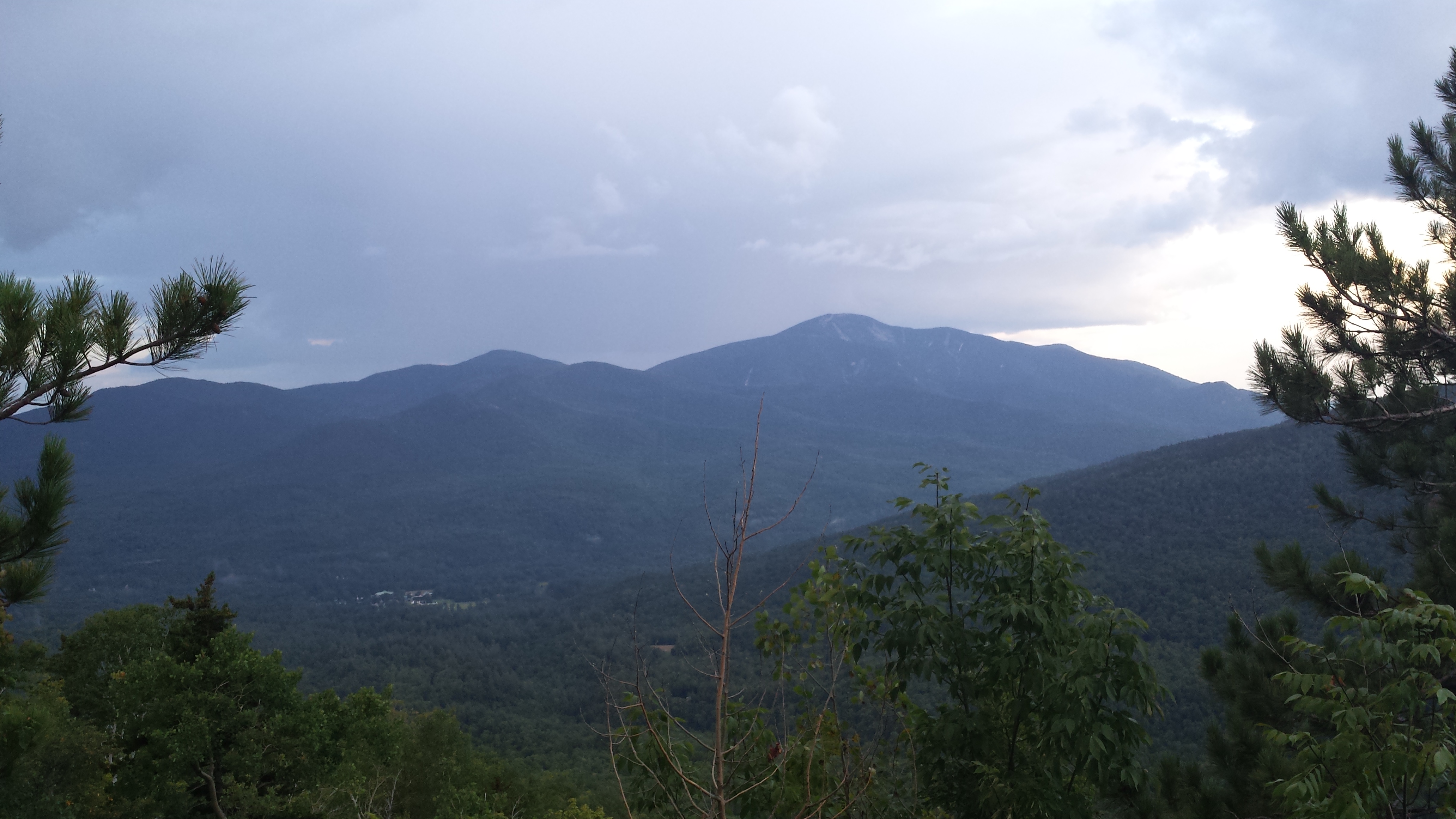
I began my journey up Big Slide at about 6pm with a trudge up the Garden road, and continued onto the Brothers trail from there. About halfway up the First Brother, thunder boomed through the Johns Brook valley, and it took just a few more minutes for sheets of rain to descend on me, only getting more intense through the more exposed sections of the climb. The terrible weather this summer did have one bright side: waking up the dormant mycelium, to the point that it was hard to go ten feet without seeing a new mushroom sprouting from the pine-needly ground. It only took a few moments searching along the trail to find the ones that would make the rest of the weekend so much more interesting. I gathered about a pound of these, tried eating one (blech!), put about half of the others in my camelback to make some improvised rikishi, and saved the rest in a plastic bag. Slowed down by slippery rock faces, it took me until about 10.00 to reach the summit. The full effect of the mushrooms hit me as I stood on that exalted summit, singing and screaming at the rain until the moon and stars finally came out (oh, what stars) then continued on my way toward the Garden and Giant, a 4 mile hike back to the road that took a bit longer than it seemed it should have, reaching the Garden at 1.45am and Keene Valley shortly after 2.
After a few false starts, I found the Ranney trail up Giant, which has no signage whatsoever along 73, let alone anything obvious or visible at night! Shortly after starting up the trail my headlamp began to give out, and I kept climbing in ever decreasing light, hoping it would at least last until sunrise and I’d have a shot at solving things later on. The trail rose steeply and relentlessly up to about 3000 feet, briefly flattened out, and appeared to end abruptly at a swamp. It was still only about 4.30 and nowhere near light enough to see much, and my headlamp was utterly useless by then in the humid fog, but I thought I could see the tracks of other lost adventurers ahead of me, and guessed straight ahead into the morass. To my horror, the water only got deeper and deeper, until I was standing almost 4 feet into the muck… but there! there, upon the tree! it was a trail marker! Seriously? It turned out this would be far from the last WTF of my hike, but I was in enough awe at having found this in the mushy shroomy misery that I continued in that general direction, and eventually, after far too long, reached the east side of the hell-pit, and curled up right there on the first patch of dry ground I saw to wait for sunrise. Adding to the general awfulness of the moment, that was also right about when I realized I’d have to head right back down the same way in only a few hours, to get back to the village to buy batteries… I decided on the way back I’d give up the time and blood bushwhacking around it to avoid smooshing through the shitfields again.
Distance: 1.8 to the Garden, 3.9 to Big Slide, 2.4 to JBL over Yard, 4.2 to the Garden, 1.8 to Keene Valley, 0.7 to the Ramney trailhead, 1.5 or so to the swamp = 16.3
Peaks: 32 Big Slide, Yard
DAY 2 (Friday 8/8)
Next thing I knew, the sun was up, and the temperature was well on its way to uncomfortable, with no sign of relief from the steaming humidity (or maybe that was just the stinking swamp behind me). I changed into some less swampy clothes, ate some clif bars for breakfast, and continued on up the trail. The rest of the way to Giant was long, dragging on, and relatively uneventful, although I wished I knew in advance that I’d be going over Hopkins, something that the map was less than forthcoming about, showing the trail to the south and about 300 vertical feet lower than the actual terrain according to my altimeter. I’d hoped to be on my way down by noon so I could get through the Ausable Club at a reasonable hour to get past the warden, but as that climb dragged on longer, punctuated by a few hang-on-for-dear-life cliffs and a lifetime supply of rapid-fire bouldering problems, the summit only seemed to get farther away at every viewpoint, and I didn’t make it to the top until almost 12, and still needed sleep badly, so I spent another two hours splayed out on the top soaking in the much needed sunshine and finally drying out before I faced a quick run to Rocky Ridge (relatively fast with no pack, and not particularly painful, just taking in the beautiful views), and starting at 4pm, the same fucking trail again on the descent.

Going down was, if this is even possible, worse still than going up. Jumping down through the boulders started to anger my knees, and barely seemed any faster than the upward climb. The little rise up Hopkins, after that, seemed almost like another 4000 footer on the range. Of course I knew on some level that it was shorter, but that didn’t make the climb any faster or easier. I started to suspect that maybe something was wrong with me, and drank about a half gallon of (shroomy) water at the next crossing. Aha! I had dehydrated myself in the heat, and I was moving at more or less full speed again.
As much as I had resolved to escape the swamp and bushwhack around it this time, my hopes of staying dry were dashed before I even reached the true start of the crossing. With about 30 meters to go, as I was starting to look to the sides and evaluate the least dismal route around the miasma, the plank bridge I was standing on decided to snap in two, giving me a set of matching scrapes up my legs and plunging me into thigh deep mud as the trees closed in on me, squirming ever closer and whispering to me not to go that way. Thoroughly demoralized twice by the same swamp, I decided the least dismal route was, in fact, straight through, having lost any hopes of dry feet for the next phase. Even during daylight, crossing wasn’t the least bit easier — perhaps even worse, seeing what looked like they should be easy ways and pursuing those and falling into entirely new traps, instead of just holding a direction, taking the pain, and coming out the other side.
Leaving the swamp, my mind began spinning on an even more distressing thought: what if I were to face another sunset here? I hadn’t seen a single person on this trail, in either direction, from 3am until 7pm. Being stuck here would almost certainly mean being stuck until morning, falling a full day behind my group, and dashing any hopes of my goal of 10 peaks. Somehow the trail managed to be kind to me though, and let me out onto the dirt road just as the last twilight was fading. I wandered back through Keene Valley and saw that I had after all missed anything being open, and couldn’t even get a cell signal to call the rest of my group to let them know I was stranded and/or needed batteries (one would cure the other, in fact). So I started heading back the other way on 73, hoping I might make it to the trailhead at least in the dark, and catch up in the morning, and maybe I could get Dial and Nippletop out of the way the last night after the Dix Range.
I’d only gotten as far as Rooster Comb, when a car stopped me, asked me if I was headed into or out of the woods. Two nice Canadians, as it turned out, who had shown up for a weekend of hiking, and realized that they had forgotten their map, and like me, had discovered nothing was open in town anymore. I explained my troubles to them, that I had no batteries and no working light. They were gladly willing to barter extra batteries for my map, and at this point I was willing to make an attempt to finish my trip, or at least make it back to my group, with no map. We ended up talking for a while at the trailhead, they were just looking for a quick place to camp for the night and had booked a shuttle to Upper Works for 5-6am to start an epic traverse of their own: Allen to Skylight and over the Great Range from there (wow. I’d have to admit that even blew my plans out of the water), and suggested that I might want to camp there with them, and take the shuttle to get the Dixes from Elk Lake, and I’d be sure to catch up with my group eventually, coming from the other side.
Now of course, I took this as a challenge. That shuttle wasn’t coming for almost 8 more hours, and I could see Nippletop in the distance, of course I’d give it a try. Being far past the hour that the Ausable would let in a “day” hiker, I realized my only way in would be over the Wolfjaws and behind Their checkpoint. So that was where I went, up the Rooster Comb trail, back down to Ausable Club land, and up to Dial at 2.45 and what I thought was Nippletop by 3.15am, making it back to our predetermined point at Ausable Road and 73 just as the shuttle arrived (late) at 5.50! I still had a chance after all! Although I will admit I misclimbed Nippletop, and actually, with it being night, me being exhausted, and having no map, I made the error of thinking the two peaks atop Dial were the nipple(s) of Nippletop and Dial.
Distance: 16.3 yesterday; 2.8 to Giant, 1 to Rocky Ridge, 1 back to Giant, 5.9 to route 73, 1.4 road walking, 3.7 to LWJ, 0.8 to UWJ, 1.8 down to Ausable Club, 1 to Dial trail, 3.6 to Dial via Elk Pass (both peaks), 3.9 to Ausable gate and shuttle; 27.9 today (in 23 hours though) = 44.2 total
Peaks: 33 Giant, 34 Rocky Ridge, Lower Wolfjaw, Upper Wolfjaw, 35 Nippletop (almost), 36 Dial
DAY 3 (Saturday 8/9)
The shuttle brought me to the Elk Lake trailhead, and I practically fell out of the van, just the half hour or so car ride being enough to painfully stiffen my exhausted body. I figured I’d just try to get a bit of the flat distance out of the way and find a place to pass out for a few hours, but once I started moving again I picked up a bit of momentum, and didn’t even stop at Slide Brook lean-to, continuing up the herd path to the slide. Just past the lean-to, I heard what I’m almost certain was a mountain lion having her breakfast. From maybe 100 meters away, I heard a few roaring growls, followed by the screech of a medium-small mammal being torn into and eaten alive! About five minutes later, the cat, if it was so, started roaring again, followed by the dismembered howls of two more of whatever these were (mink? fisher-cat? flying squirrel?)
I must say there is nothing more effective than the primal rush of hearing sounds like that to want to move faster… I barely stopped the entire way up the Macomb slide, fighting my way against the scree and a body begging me to stop, until I was sure the cat didn’t want a main course with that appetizer of mink tartare! Frightened as I was by the cat, I had neglected to even fill my water on the way up Macomb, and found myself completely dry before even reaching the first summit of the range, with no known water without too much descent until the Dix Slide. I slept here for about 3 hours until just after noon, once the adrenaline from the cat encounter calmed down, and was surprised, amazed even, at how refreshed I felt afterwards. Unfortunately the rest of my mushrooms went rotten but the shroom-water still seemed as effective as ever.
The bushwhack up to the top of Macomb sucked, but was far from the worst I’d ever seen, and navigation wasn’t much of a question: there was only one way to go, up, and eventually a herd path reassembled leading to the summit. Passing through the col toward Carson, I heard what I thought was water and plunged into the spruces to refill. It wasn’t the easiest water to get to, certainly wasn’t the best tasting (unless you drink Pine-Sol and like it), but it was certainly a life saver up here.
I summited Carson shortly afterward and left my pack behind to go get Grace, neither one of which was much of a challenge, or offered too much of a different view compared to Macomb before, and Hough and Dix afterward.
It took me just about 15 minutes to get from Carson to Pough, and a steep 40 minutes or so up from Pough to Hough, at which point I had (briefly) thought I’d already reached the Beckhorn. Asking another climber deflated that quickly enough; I’d forgotten, especially with no map, that Pough even existed, and it should have been obvious anyway that there was quite a drop between Beckhorn and Dix.

But even the real climb up Dix wasn’t too bad, and for the first time I’d actually found a crowded summit, with the usual French Canadians, a group of photographers and a pair of friends hiking up from New Jersey (one of whom would eventually be very relevant to me), but still no sign of my group. Now thoroughly confused as to where they could be, especially since I should have at a minimum seen them on the Range by now, I laid down to rest, and flickered in and out of sleep until sunset and the start of the cold winds, near enough to trail that my friends would have seen me for sure if they were actually there. Frustrated and more than a little bit worried though, I realized I should probably start descending.
The trail down to the Hunters Pass junction was typical over-4000 fare, a quick but steep descent with plenty to hold onto and mostly dry rocks. Then started what has to be one of the steepest drops in the entire High Peaks, a punishing drop of at least 400 feet before I cut into the trees looking for the smooth, inviting slide I’d seen from the summit. After an agonizing 100 meters that probably took close to half an hour, I found the slide, and followed it quickly and easily back to 3300 feet, then bumbled around looking for trail, and thinking constantly that I heard voices off somewhere in the woods, as I cursed my inability to use my hashing skills to get out of this one… no trail markers to be found, let alone a trail, just a braided estuary of Boquet River forks going more or less nowhere, and more or less forward.
Knowing sooner or later the trail would appear, or if not, the lean-to, I followed the water, and reached the Boquet Lean-to at 1.30am, and found to my surprise, my tent there (that I had let my group borrow), but no fellow Dix Range survivors. I slept in the tent, the closest thing to a normal night’s sleep I’d had yet, and woke up well after first light, having missed my alarm by hours too!
Distance: 44.2 start, 2.3 to Macomb Slide, 1.3 to Macomb, 0.9 to Carson, 1 to Grace, 1 back from Grace, 0.3 to Pough, 0.6 to Hough, 1.2 to Dix, 0.4 to Hunters Pass junction, 2.2 to Boquet lean-to = 11.2 today, 55.4 total
Peaks: 37 Macomb, 38 Carson, 39 Grace, 40 Hough, 41 Dix
Day 4 (Sunday 8/10)
Even waking up as late as I did, I figured with under 6 miles to go, I could probably make it down to 73 in time at least, and hitch the last few miles to Keene Valley, avoiding the road walk, to make my bus out in time. Those 6 miles though proved to be almost nothing but obnoxious curves and stream crossings and vertical ticky-tacky hills, the only person I saw was a trail runner named Cory (the same Cory who set the 46 peaks record last year? I have to wonder) who I asked to tell Christian and Niky that I climbed all 11 and was on my way out. I didn’t get out of the woods until after 11am, well too late to walk to Keene, and sat and stood and paced alongside route 73 for almost an hour with no one even slowing down let alone picking me up.
After the bus whizzed past, I took advantage of a brief window of perhaps being able to chase it, and a Canadian was willing to try to catch it as far as routes 73/9N, find it on its way past the Wilmington stop. Seeing no sign of it after a half hour giving chase, he let me back off at 73 and 9 and headed off toward Québec, leaving me on the roadside. I walked painfully back to Round Pond and hoped at some point my group would appear, or some other way out. As soon as I got back to the trailhead, Cory reappeared, somehow having run the entire Dix range in no more than 4 hours. Holy shit… Somehow though he didn’t see any sign of my group up there, I wonder where they might have gone…
A ranger showed up soon afterward to question me, thinking, probably rightfully so, that I was in some sort of trouble. I wasn’t who he was looking for though. Apparently they saw lights on Dial and Nippletop night before last and no one was in the register and they were *still* searching for them, thinking there were still hikers lost in the woods. I wondered whether I should tell the ranger that it was me, and decided that wouldn’t help my situation any, and just asked if he’d seen any signs of my group instead. I think he might have been wondering himself though, and I wasn’t about to incriminate myself without a really good reason to.
I spent most of the day stuck on route 73, as one hiker after another finished the trail and was going exactly where I wasn’t, but eventually after hours of waiting acquired a pen and paper to make a sign saying “ALBANY”. Probably something I should remember for next time…
It took less than a minute after that for me to get picked up, by a Subaru absolutely BLASTING the Mars Volta. Of course it would… the very song that convinced me to be here in the first place! It was someone I’d met on the summit, but I unfortunately forgot his name… We traded stories of our climbs, had a pleasant ride out to Albany, and somehow I made it home. I found out the next day that, as long as I took, my group was STILL behind me and got out just before dark, having taken an adventurous route of their own down Macomb slide, and up and down a few others, along with the rest of the peaks, but after the weekend, just as we’d hoped, we’re all tied at 41 peaks, and can actually finish this summer, together, in a much more pleasant way!
Distance: 55.2 start, 5.6 to Route 73, 3 miles back from first dropoff, 63.8 total for the weekend.
Peaks: None. I don’t think I could have handled even one more.
Day 5 (Monday 8/11)
Ouch. Ouch. Ouch.